SIGN UP FOR OUR
Starting with Costa Rica’s coasts, and later continuing inland throughout the territory, the National Institute of Innovation and Transfer in Agricultural Technology (INTA, its acronym in Spanish) is about to embark upon a much-needed land-use mapping project.
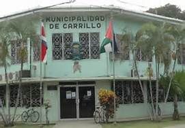
The new maps will prove an essential tool for Costa Rica’s municipal governments to draw up and enforce zoning plans. And zoning plans are what allow for clear guidelines on where different types of businesses, infrastructure, and other types of development, including agriculture, can be established and operate, said the Ministry of Agriculture and Livestock (MAG, its acronym in Spanish) in a press statement.
Starting next month, 20 new officials from the MAG will be trained to carry out the mapping of 25,000 square kms of territory in the cantons along the Pacific and Caribbean (Atlantic) coasts. The maps will be drawn up on a scale of 1:50,000, said the MAG.
MAG-trained topographers will collect and register descriptions of different soil types and their locations which will be entered into a database from which digital maps can be created. The digital maps of each canton will be readily accessible to local governments as well as other institutions, such as the Agricultural Ministry, that need the data for building permits, planning, agricultural zoning, and land titling.
According to Renato Jiménez Zúñiga, head of the Technical Services Department of INTA, surveyors will use as a guide the most recent (2014) Manual of Soil Survey of the Department of Agriculture of the United States of America (USDA), which provides a standardized methodology and guarantees the quality of the data to be collected.
The Costa Rican Institute of Rural Development (INDER) will provide financial resources for the mapping project, which includes soil and water sample data (to be analyzed by the INTA’s laboratory).
The new maps will also specifically help the National System of Conservation Areas (SINAC) in clearly defining the boundaries of existing protected areas, and the Costa Rican Tourism Institute (ICT) for its tourism regulatory plans, said the MAG.
And finally, the National Irrigation and Drainage Service (SENARA) said the data from soil and water samples will assist them in better understanding the country’s aquifers, their capacity and current status.