SIGN UP FOR OUR


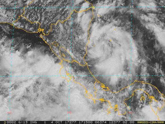
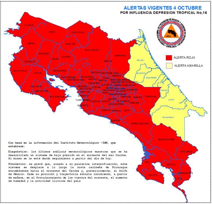

Costa Rican emergency officials have placed the entire country on alert for heavy rains predicted for later this week and possibly into the weekend. The central and Pacific regions of Costa Rica are expected to take the brunt of the effects of a storm expected to form later today in the western Caribbean Sea.
Hurricane experts in the U.S. said the system, currently called Invest 90L, “will bring locally heavy rain to parts of Central America in the next few days.”
“The disturbance, called Invest 90L by the National Hurricane Center (NHC), is currently located in the southwestern Caribbean Sea off the coast of Nicaragua and is expected to slingshot northward through this week and into the upcoming weekend,” said meteorologists at the Weather Channel.
The current above-average high water temperatures in the western Caribbean – mid- to upper 80s – are conditions that have historically supported the development of tropical storms and hurricanes, said experts.
“In addition to the warm surface temperatures, the warmth runs hundreds of feet deep in the northern and western Caribbean Sea and parts of the Gulf of Mexico, by far and away the greatest ocean heat content anywhere in the Atlantic basin right now.
“The tropical system is expected to be pulled north into the Gulf of Mexico, steered by the combination of upper-level high pressure centered near or east of the Bahamas and what is known as a Central American gyre,” continued the meteorologists.
The developing storm that may result from the Central American gyre – a large, broad area of low pressure over the Central American isthmus and reaching eastward into the western border of the Caribbean Sea – has the potential of becoming a tropical cyclone, said experts.
“These Central American gyres are notorious for flooding rainfall over Central America and Mexico, and this one will be no exception.
“Areas of locally heavy rain are likely to persist at least into part of the weekend from eastern Mexico into Guatemala, Honduras, El Salvador, Nicaragua, Costa Rica and, perhaps parts of Panama.
“This heavy rain may trigger dangerous flash flooding and mudslides, particularly over the mountainous terrain of Central America,” warned meteorologists.
So, prepare for more rain, mud and all the rest, especially if you are near rivers or steep terrains.
About 50 percent of Central American gyres have a tropical cyclone associated with them, according to Philippe Papin, Ph.D. candidate at the University of Albany. Hurricane Stan in 2005 is a good example of a hurricane’s interaction with a Central American Gyre, continued Papin.
“Following Stan’s dissipation over the mountains of central Mexico, its remnant spin became part of a larger gyre that caused heavy rainfall over Central America. While Stan’s direct circulation resulted in around 80 deaths, according to the National Hurricane Center, heavy rainfall resulting from the gyre took more than 1,000 lives across Central America.”